The Great Flood of 1986 in Michigan was one of the worst extreme weather events in the state’s history. The deadly storm system covered an area 180 miles east to west and 60 miles north to south dumping torrential amounts of rain over the course of three days. The storm hit hardest in the Saginaw Bay and Thumb regions where 22 counties
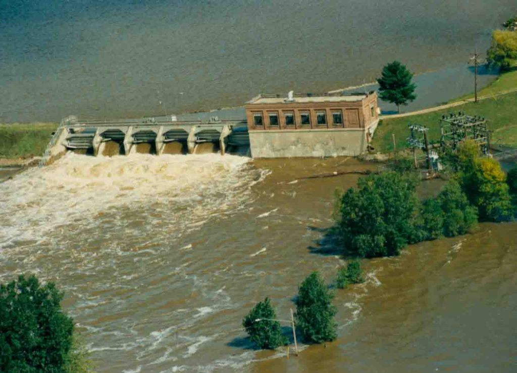
High water at the Sanford Dam. Photo credit: Midland County Historical Society
were declared federal disaster areas impacting more than 1.8 million residents.
The rain began late Tuesday evening on Sept. 9, 1986, in west central lower Michigan and gradually moved east into the Thumb region. From September 10 to 12 rainfall over central lower Michigan averaged between 8 inches and 14 inches. Rivers across the region flooded their banks. The Tittabawassee River at Midland, Pine River at Alma, and Cass River at Vassar and Frankenmuth, all reached new records for peak flows during the storm. The Cass River rose to a peak of 24.8 feet — a full 20 feet above its normal height. Eleven dams failed including the Hart Dam in Oceana County, which emptied out Hart Lake destroying the southbound portion of the U.S. 31 Bridge and forcing 300 people to evacuate their homes. Across the state, more than 3,600 miles of road and 30,000 homes were flooded.
The long-term impacts of the storm were devastating both in lives lost and economic damage. Ten people died as a result of the storm. The Federal Emergency Management Agency estimated total economic damages from the storm at over $505 million (more than $1 billion in 2016 dollars). Because the storm came during harvest season, farmers were especially hard hit and faced $300 million in crop damages.
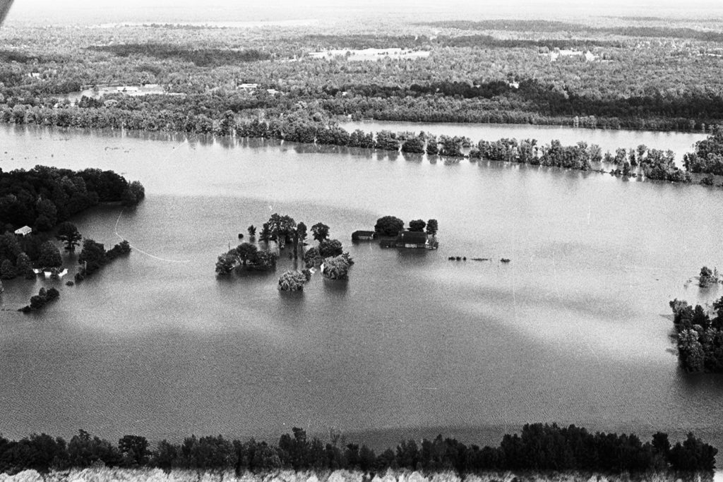
Flooded farmin Midland County. Photo Credit: Midland Office of Emergency Management
The Great Flood of 1986 also played an important role in shaping how communities in the Saginaw Bay region prepare for and respond to extreme storm events. As William Wright, a planner with Saginaw County during 1986 flood, explains, “One positive outcome was the realization among public officials from throughout the region that we are all vulnerable to flooding in this watershed, and we’d best all work together to address watershed management issues.” New river assessment and flood warning procedures were developed in several communities as a direct response to the 1986 flood.
The thirty years since the flood have brought major technological advancements in flood forecasting and response. In 1986 many residents and public officials did not have access to the information needed to accurately predict crest levels on local river tributaries. Today, automated river gauges and the use of Doppler radar to monitor storms make flood predictions much more accurate. The internet has dramatically improved communication and data sharing capacity between local emergency managers, first responders, the public, and key federal agencies such as the National Weather Service and the United States Geological Survey.